|
| *****SWAAG_ID***** | 903 |
| Date Entered | 08/11/2015 |
| Updated on | 08/11/2015 |
| Recorded by | Tim Laurie |
| Category | Burial Mounds and Cairns |
| Record Type | Archaeology |
| Site Access | Public Access Land |
| Record Date | 02/10/2015 |
| Location | Faggergill Scar |
| Civil Parish | Arkengarthdale |
| Brit. National Grid | NY 07604 |
| Altitude | 484m |
| Geology | Namurian chert and sandstone strata above the Main Limestone and below the Little Limestone |
| Record Name | Four stone prehistoric cairns on Faggergill Scar. One with a visible cist (Cairn Four). |
| Record Description | All four cairns which were first recognised by Shirley Gale, are located at fine viewpoints on the front edge of the escarpment with views down through Faggergill. These four cairns will probably be intervisible (to check) with the large round cairn at Little Punchard (see SWAAG Record 166). Each Cairn will be briefly described here and photo images are provided below.
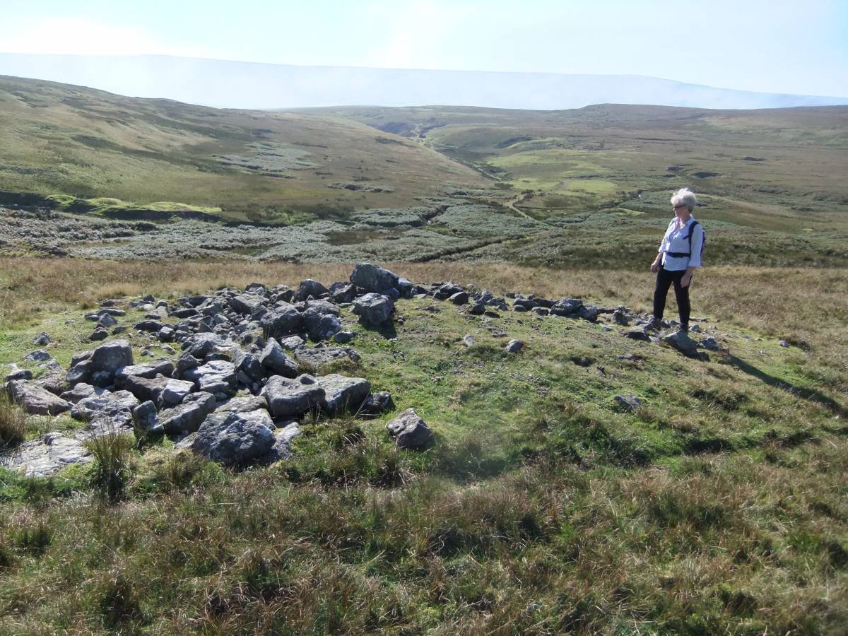
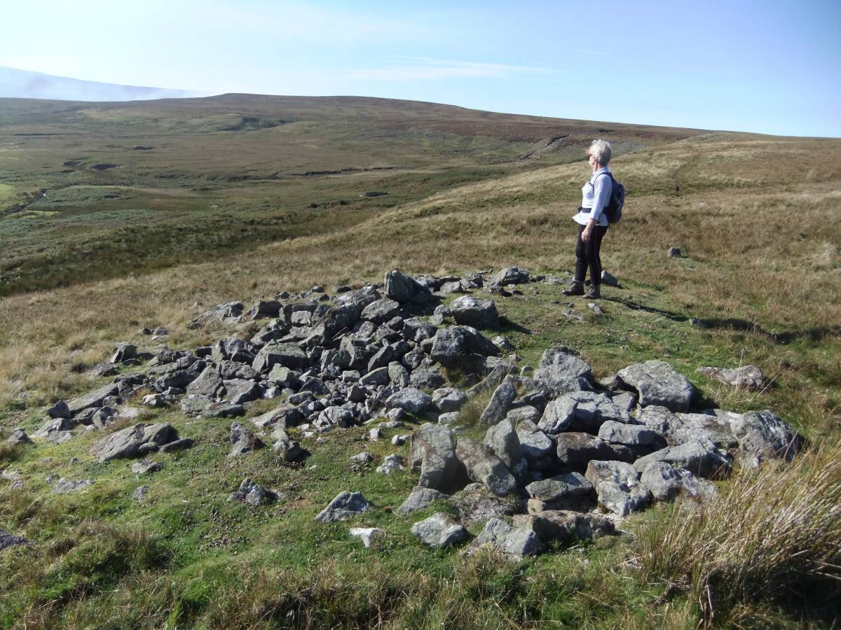
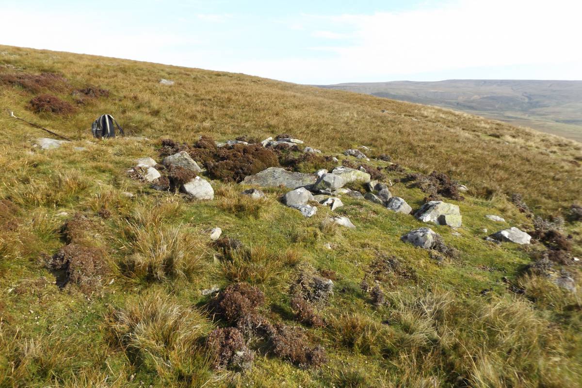
Cairn One. (NY9949907604) is the most easterly cairn being located close to the eastern end of the Scar. Cairn One is oval on plan and measures 9m *6m overall. Since Cairn One is just some 50m distant from the stone quarry close to the track at the eastern end of Faggergill Scar, it is surprising that it has survived relatively undisturbed, although it is somewhat reduced in height by stone robbing.
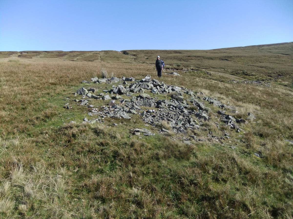
Cairn Two (NY9945207627) is a very small cairn which measures some 5m*4m on plan and is barely visible in the vegetation at the edge of the Scar.
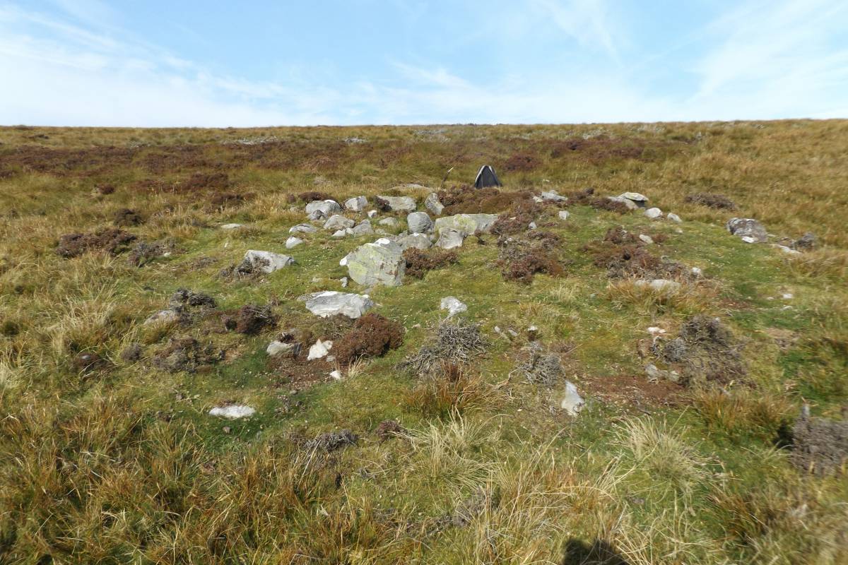
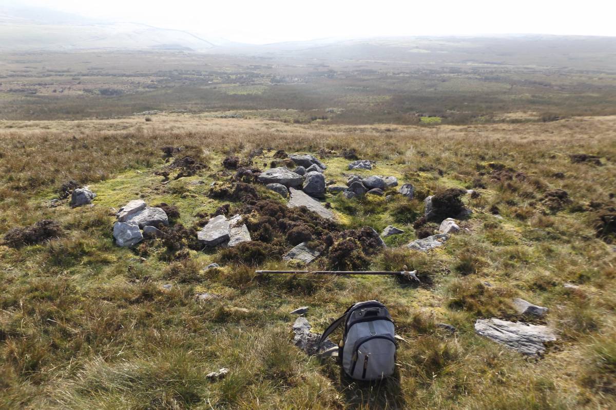
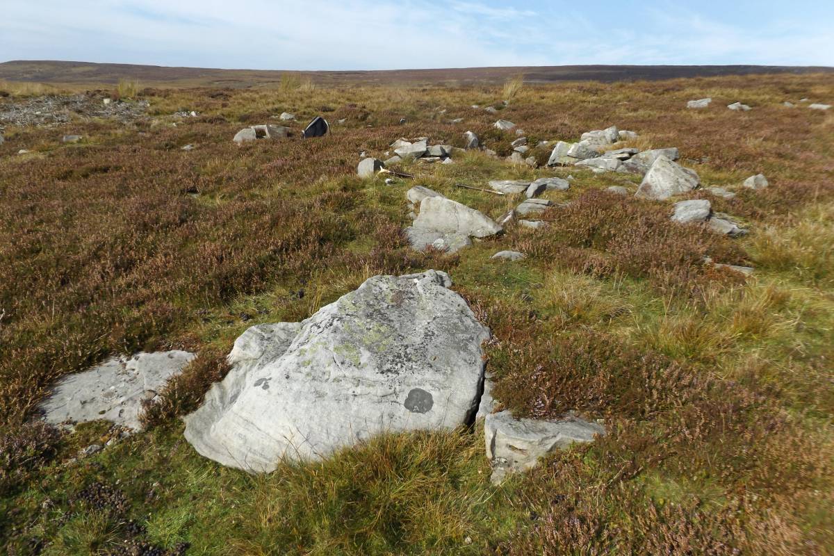
Cairn Three (NY9844007319) is circular on plan and 6m diameter.
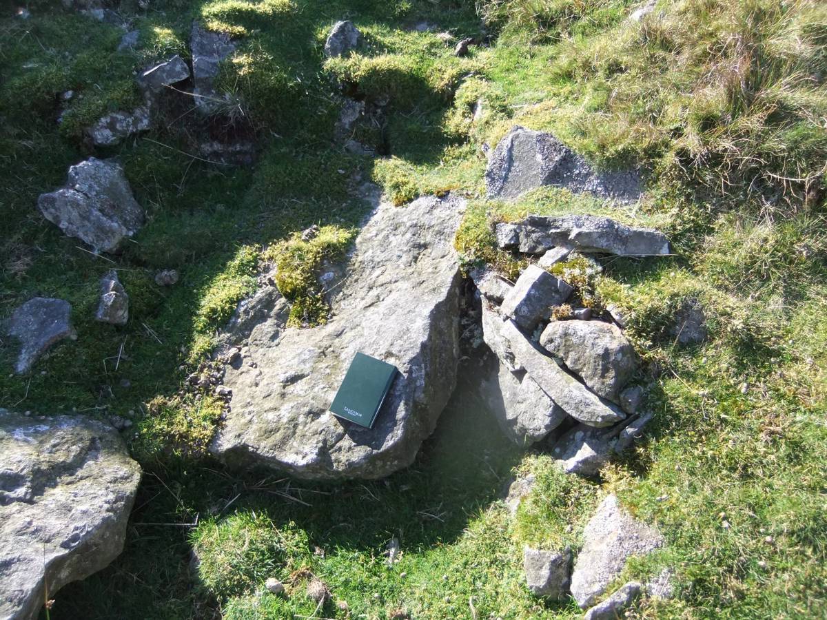
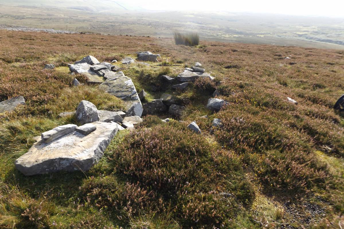
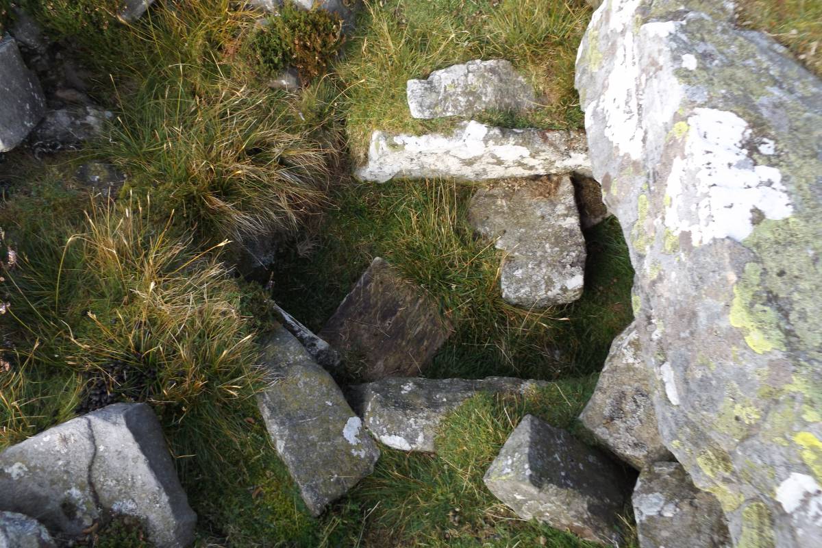
Cairn Four (NY9825407284) is also circular and measures 5m in diameter. Cairn Four has a visible stone lined rectangular cist which has been opened, probably by fox hunters seeking to release their terriers rather than by antiquarians. Two sections of the broken cist cover slab can be recognised as laid on one side. |
| Dimensions | The cairns vary in size from 5m diametet to a maximum of 9m diameter. |
| Additional Notes | These cairns are an element within the increasingly interesting prehistoric landscapes of Arkengarthdale and of Stainmore, which includes, inter al. the large burnt mound and small ring cairn located further down Faggergill which were also recognised by Shirley. Further field work will be required to determine the full extent of the prehistoric and later landscapes of Faggergill and of the eastern approaches to the Stainmore Pass.
In view of the sensitivity of cairns with cist burials to interference, this record is restricted to SWAAG Membership. |
| Image 1 ID | 6531 Click image to enlarge |
| Image 1 Description | Cairn One at eastern end of the Scar. The view south eastward, with Shirley who first recognised these cairns. |  |
| Image 2 ID | 6532 Click image to enlarge |
| Image 2 Description | Cairn One, the view to the north west. |  |
| Image 3 ID | 6533 Click image to enlarge |
| Image 3 Description | Cairn One, the view eastward with Eileen. |  |
| Image 4 ID | 6534 Click image to enlarge |
| Image 4 Description | View eastward across the low, and not prominent Cairn Two towards Cairn One |  |
| Image 5 ID | 6535 Click image to enlarge |
| Image 5 Description | Cairn Three | 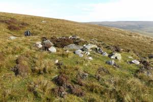 |
| Image 6 ID | 6536 Click image to enlarge |
| Image 6 Description | Cairn Three | 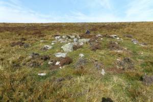 |
| Image 7 ID | 6537 Click image to enlarge |
| Image 7 Description | Cairn Three | 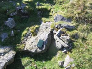 |
| Image 8 ID | 6538 Click image to enlarge |
| Image 8 Description | Cairn Three | 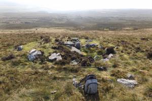 |
| Image 9 ID | 6539 Click image to enlarge |
| Image 9 Description | Cairn Four. This cairn has a visible cist which has been opened probably during fox hunting to release a terrier. | 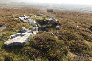 |
| Image 10 ID | 6540 Click image to enlarge |
| Image 10 Description | Cairn Four with visible cist |  |
| Image 11 ID | 6543 Click image to enlarge |
| Image 11 Description | Cairn Four. The cist, detail. |  |